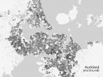
The Global Human Settlement Layer (GHSL) project produces global spatial information about the human presence on the planet over time. This in the form of built-up maps, population...
To improve the understanding of current trends in global urbanization, ESA and the German Aerospace Center (DLR) are jointly developing the world's most comprehensive dataset on human settlement.
The Department of Energy Planning of the City of Vienna acquired information on urban heat islands, useful to implement mitigating measures, on the basis of information derived from Earth observation.
During this webinar you will discover how Sentinel satellite data and EO services, available in Terrascope, were used to develop an online tool to automatically monitor...
The benefits of space services and data for sustainability and smart mobility are currently under the spotlight as the Union is investing more on its EU Space Programme for the definition of its...
The workshop focuses on the application of the Degree of Urbanisation, offering the basic knowledge and means to produce population grids, settlement grids, and classification of local units into cities, towns and semi-dense...
Since the advent of the openly accessible Sentinel satellite data as part of the Copernicus programme of the European Commission and ESA, massive amounts of satellite data have brought disruptive changes...
This webinar, dedicated to start-ups and SMEs in the urban mobility sector, will be a great opportunity for participants to better understand how to leverage geolocation in their solutions to improve...