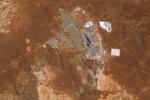
The Copernicus EMS Rapid Mapping module received five activation requests between November 2021 and March 2022 to monitor the impact of the floods on local communities.
Search results (5)
Showing results 1 to 5
Knowledge service
Earth Observation Geographic coverage
Australia
A new report from Digital Earth Australia (DEA) highlights the increasing role of Earth Observation data and services in Australia’s 150 billion dollar plus mining sector.
Australian wildfires released more than twice as much carbon dioxide in the 2019-2020 season than expected, scientists are realizing based on new analysis of satellite data.
Satellite radar images have long been used to predict and capture the early warning signs of impending natural disasters, including landslides—tons of rock, earth, mud...
This paper describes the Australian Geoscience Data Cube (AGDC), a ‘Big Data’ infrastructure that aims to realise the full potential of Earth observation data holdings for Australia.