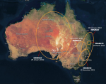
The Copernicus EMS Rapid Mapping module received five activation requests between November 2021 and March 2022 to monitor the impact of the floods on local communities.

We enable the uptake of state-of-the-art knowledge from Earth Observation for EU policies and better regulation.


