Crop wild relatives (CWR) are plant taxa closely related to crops and are a source of high genetic diversity that can help adapt crops to the impacts...
Search results (32)
Showing results 1 to 10
Geographic coverage
America
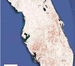
AI satellite mapping can quickly pinpoint hurricane damage across an entire state to spot where people may be trapped
By using satellite images from before the storm and real-time images from four satellite sensors, together with AI team of spatial and environmental analysts created a disaster monitoring system that can...
The WorldPop project was initiated in 2013 to unite the continent-focussed AfriPop, AsiaPop and AmeriPop projects, with an aim of producing detailed and freely-available population distribution and composition maps for the whole...
Highlights
The study reviews ex-post impact assessment studies on improved rice varieties.
Articles were published between 2016 and 2021.
Stress-tolerant varieties significantly...
Within this generic scoping report of the Regional Assessments of Biodiversity and Ecosystem Services, the Americas Assessment considers these effects, as well as future threats to biodiversity and ecosystem services...
A new International Institute for Applied Systems Analysis (IIASA)-led study proposes a novel method to estimate global economic well-being using nighttime satellite images.

Integrated mixed crop-livestock farming systems help improve farm sustainability by securing agricultural incomes through the diversification of productions and by enhancing farm autonomy regarding agricultural...
LAC’s rural territories produce food for more than 800 million people; cultivate 14 % of the world’s crops; are home to a large part of the planet’s biodiversity...
Livestock in the Amazon is mainly limited by the lack of forage biomass production in the dry season. The sensitivity of pasture to drought depends on pasture management and on certain natural factors that enable...