Overview
Sustainable development, eradication of extreme poverty and stability are the ultimate goals of the European development policy. The EU and its member countries provide over half of all global development aid, investing in peace and security around the world. Key reference elements for the development policy of the EU are the objectives of the Sustainable Development Goals, the long-lasting partnership with African, Caribbean, and Pacific (ACP) countries, the policy coherence for development striving to increase the effectiveness and sustainability of European development aid, minimizing contradictions and building synergies between different EU policies, vis à vis the increasing challenges caused by conflicts and climate change.
Copernicus supports EU development policies by providing relevant products and services on land, atmosphere, marine environment and climate data records and projections. In this regard, Europe and Africa have been pursuing collaborative efforts in satellite-based Earth Observation with applications and technologies in a wide range of domains, the main ones being sustainable economic development, environment development, protection of the population and food security. More recently, the European Green Deal and Digital Agenda are expected to further enhance Europe-Africa cooperation in space and EO, highlighting the need to guarantee a stepwise approach for the development of sophisticated decision-making systems to observe and act on the earth system and environment.
In general terms, partner countries are in particular interested in EO products that can help to improve land planning, land use and natural resources management, environmental monitoring, regional development, marine and coastal resources, fisheries management, agriculture and forest products, water management, access to energy as well as disaster risk prevention, management and response.
EO information is also significantly used by EU Delegations in a multitude of rural development projects, with the main aims of increasing natural resources related information availability and for monitoring project implementation and impact.
GMES & Africa
Copernicus and its predecessor GMES have been used extensively in Africa. The initiative on GMES & Africa, initiated by the Lisbon declaration in 2007 during the 2nd EU-Africa summit in response to the Maputo Declaration of 2006 calling for an extension of GMES to ACP countries, has been a big step forward to establish Earth Observation services in Africa, making optimal use and making the most of the Copernicus programme.
GMES & Africa builds on the achievements and the networks established by several precursor projects such as PUMA (2001-2005), AMESD (2007-2012) and MESA (2013-2017) that promoted the development of local capacities, institutional, human and technical resources for access to and exploitation of EO-based services. Following the long-term structured dialogue between Africa and Europe on EO systems, substantial progress has been achieved in the use of EO data and in the development of applications and services to respond to global needs, to manage the environment, understand and mitigate the effects of climate change and ensure civil security by providing information to policymakers, scientists, businesses and the public on a real-time basis.
The eStation 2.0 system is among the concrete outcomes of the initiative. Developed since 2009, eStation is designed to automatically deal with the acquisition, processing, visualization and analysis of key environmental parameters derived from a variety of remotely sensed data sources. The system offers a highly customized web client, made available to different end-users for computing ad-hoc thematic products and environmental indicators. The eStation has been distributed to a number of African countries and is being further developed and customized for the beneficiaries of the GMES & Africa support program as part of the capacity building activities of the initiative.
The African Union has expressed interest in further developing services related to coastal monitoring, maritime security, fisheries management, wetland and conventions monitoring, forest management, flood management, water services, agriculture and disaster management.
Rural Development and Food Security
Agriculture has a strong multiplier impact on the economies of developing countries. As a matter of fact, sustainable agriculture and food and nutrition security are at the top of the EU long-term development cooperation agenda. Agriculture that is sustainable, inclusive and protects biodiversity can play a major role in eradicating poverty, food insecurity and undernutrition. Farmers in developing countries face multiple and complex challenges: climate change, environmental degradation, economic upheaval, water scarcity, increased pollution and dietary health concerns, and rapid population growth. Furthermore, agriculture has a huge environmental footprint as it generates almost a quarter of greenhouse gases as well as being impacted by climate changes.
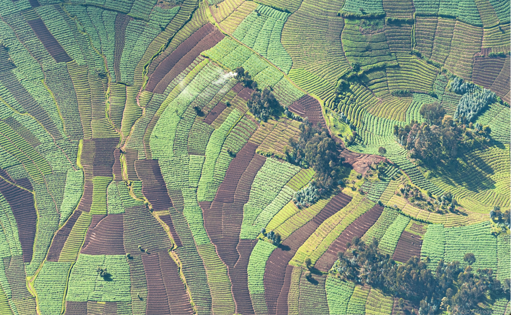
A wealth of relevant evidence can be generated from EO data in support of rural development and food security policies, with different domain applications regarding for example land governance and management, water quality and quantity, food security early warning systems.
The strong spatial dimension in land governance and management systems makes EO an ideal tool to provide to spatial framework to support operation. The increased availability of high spatial and temporal resolution data from Sentinel 2 made available through various dedicated platforms such as Sen2-Agri, an operational system generating agricultural products from Sentinel 2 and Landsat 8 time series, represents a big step forward for the agriculture sector.
Using water resources in a sustainable manner is a major challenge and agriculture is a key water user. Water products (water levels, water quality) are important to support irrigation, access to water for cities and villages, share of water resources between countries. Farmers and pastoralists need water short-term forecast of key parameters, as it can be very effective in reducing losses of cattle/crops.
Using a variety of EO sources and products, FAO has developed WaPOR, a database publicly accessible enabling near real time monitoring of the performance of water use in agriculture in African countries.
Early warning systems provide timely information on food availability or food access limitations around the world, with EO data providing key input for qualitative analysis and also for quantitative yield estimation, as well as direct information to assess food access limitations due to weather extremes such as droughts and floods that negatively impact food availability. Examples of early warning systems that monitor crops and detect anomalies in food production, are the Anomaly Hotspots of Agricultural Production (ASAP) by the JRC and the Crop Monitor for Early Warning (CM4EW) by GEOGLAM. Early warning systems generally use medium-low resolution satellite data for retrieval of near real time information and weather indicators. Copernicus Sentinels high resolution imagery help significantly to build the necessary baseline layers. By all means, data from the Sentinel 2 mission has dramatically increased the capabilities for agricultural monitoring and crop management worldwide.
A specific challenge for food security in many arid and semi-arid regions is the Desert Locust. To help monitor and control the locust, FAO operates its global Desert Locust Information Service (DLIS) providing forecasts, early warning and alerts on the timing, scale and location of invasions and breeding. Weather, habitat data and satellite imagery are analysed to assess the current locust situation, providing forecasts up to six weeks in advance and issuing warnings on an ad-hoc basis through the Locust Watch. Key inputs to support the assessments and the affected countries are greenness maps derived from Copernicus Sentinels data. The maps timely show the evolution of vegetation along the seasonal cycle from the very onset, in locust habitat areas ranging from Mauritania to India.
Climate change
The Intra-ACP Climate Services and related applications programme (a.k.a. ClimSA) launched in 2018, is an initiative of the Organisation of the African, Caribbean and Pacific States (OACPS) funded under the 11th European Development Fund (EDF) to support the climate information services value chain in ACP Regions, through the provision of technical assistance, financial assistance, infrastructure, and capacity building to improve and widen access and use of climate information.
ClimSA aims at contributing to improved quality and quantity of products from regional climate services offered by ACP regional climate centres and national hydro-meteorological organisations for 5 climate-sensitive sectors: agriculture and food security, health, water, disaster risk reduction and energy. It is intended to foster sustainable development through prevention of desertification, preservation of ecological biodiversity and sustainable use of water management by supporting the decision-making process for informed adaptation options to climate change.
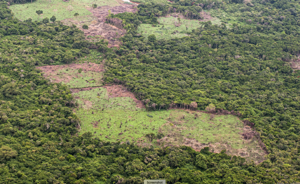
Reducing deforestation and forest degradation
UNFCCC launched in 2007 the REDD+ initiative, aimed at reducing emissions from deforestation and forest degradation in the tropical belt, recognizing the importance of conservation, sustainable management and enhancement of forests carbon stocks.
The continuous and increased availability of open geospatial data on the status of forests worldwide and the increased capacity of developing countries to process such data are key elements supporting REDD+
The Roadless-For pilot project (ended in 2018) and the Tropical Forest Monitoring component part of the ForMonPol (Forest Monitoring for Policies) project are two European Commission studies on REDD+ built on geospatial data. The two projects have produced a new dataset on forest cover change in the tropical moist forests (TMF) using 38 years of Landsat time series. The beneficiaries include tropical countries, EU member states and the scientific community.
The Copernicus Sentinel data with high spatial resolution and revisit time provide an unprecedent opportunity for improved forest monitoring; a framework to propose a dedicated Copernicus REDD+ Service is being studied by the JRC.
Additional information on EO uptake for REDD+ in the dedicated feature content page of KCEO
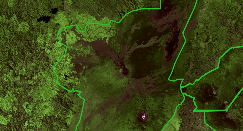
Natural resources and biodiversity
Biodiversity loss, climate change and environmental degradation require coordinated and incisive international efforts. In line with the Green Deal’s action to preserve biodiversity and revert loss, the preservation of adequate levels of biodiversity is absolutely critical in many partner countries.
The BIOPAMA (Biodiversity and Protected Areas Management) project assists the African, Caribbean and Pacific (ACP) countries to address their priorities for improved management and governance of biodiversity and natural resources, implementing a series of indicators and delivering geospatial information derived from EO. Examples include indicators based on land use, surface water extent, built up areas, forest loss and degradation. At the global scale, a similar set of EO derived indicators are used by the Digital Observatory of Protected Areas (DOPA), web services and applications to assess the state of and the pressure on protected areas at multiple scales. The Copernicus Global Land Service, and in particular the Hot Spot Monitoring, delivers detailed time series of land cover data for a number of key terrestrial ecosystems in ACP countries
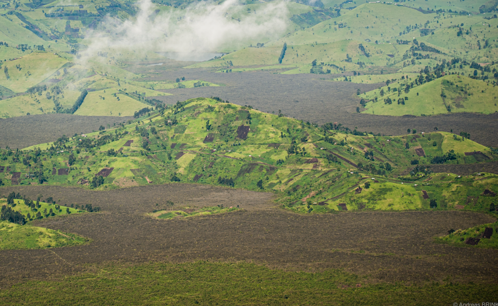
Land degradation and desertification
Land degradation and its ultimate state, desertification, are serious threats around the globe and in particular in arid, semi-arid and dry sub-humid regions, driven by growing human pressure on natural resources combined with natural processes and exacerbated by climate change. The need of mapping and monitoring global desertification has been recognized as key action since the first UN Conference on Desertification in 1977, a first World Atlas of Desertification (WAD) was developed in preparation of the Rio Conference in 1992 and further developed after the establishment of the UN Convention to Combat Desertification (UNCCD).
In 2018 a third edition of WAD was compiled under JRC coordination, addressing the full complexity of the land degradation phenomenon and all the human factors that both drive it and are derived from it. The global analysis of desertification and land degradation processes has evolved in this new Atlas, encompassing various aspects of human presence, or dominance, and the complex socio-economic and environmental interactions. The mapping component of the Atlas uses and integrates a variety of geospatial data derived from EO regarding both bio-physical and socio-economic dimensions.
EO is crucial for the continued monitoring of the state and condition of the land and the convergence of this with other ongoing land change processes is crucial in mitigation and restauration of land degradation.
Humanitarian aid and emergency management
The economic growth of developing countries is strongly vulnerable to increasingly frequent devastating weather extremes. Copernicus Emergency Management Service (CEMS) provides key information for emergency response and disaster risk management.
Using EO and model data, CEMS supports all actors involved in the management of natural or manmade disasters by providing geospatial data, images, maps, time-series or other relevant information to better manage disaster risk. The products are shared among all actors and agencies involved in an incident to enable timely and consistent response actions.
Common information on disaster management includes data on human population, human and critical infrastructure, land cover, topography, water bodies, etc. Additional detailed information is necessary for each type of disaster (e.g., extent of the burnt area for forest fires, flood extent and water depth for floods, etc.)
| Originally Published | Last Updated | 10 Jun 2021 | 17 Mar 2022 |
| Knowledge service | Metadata | Earth Observation |